SoFoBoMo where are you?
Based on the idea over on Sam's blog, please add yourself to the map if you've been in on the whole SoFoBoMo experience. You can also link to the map with this url : http://www.frappr.com/sofobomo


Based on the idea over on Sam's blog, please add yourself to the map if you've been in on the whole SoFoBoMo experience. You can also link to the map with this url : http://www.frappr.com/sofobomo
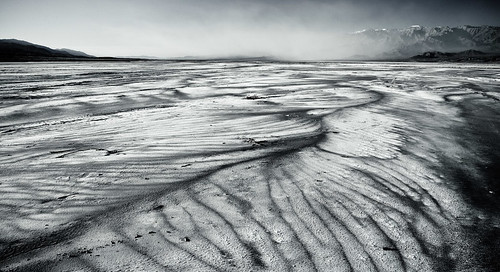
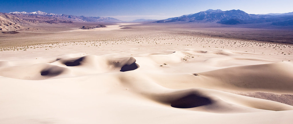
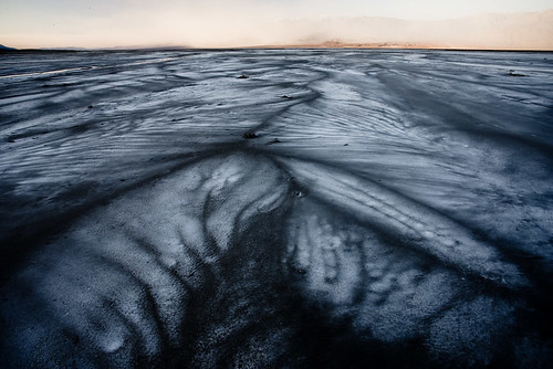 Instead I went with another group down towards the salt flats near Cow creek. I'd scouted that area on the Saturday when I'd arrived and found some really beautiful fan shapes in the salt. I'd walked out without my camera, towards the center of the valley on that first day, just to get away from everything and listen to the wind. The water and wind had blown rivulets into the salt pan and the shapes were achingly delicate. I'd hoped to come back when the light was good and marked some GPS co-ordinates so I could find it easily.
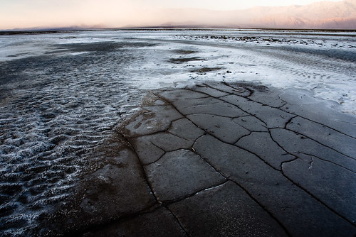 So on the last morning, I got my chance to go back and it was breathtaking all over again. Such graceful sweeping patterns leading off to the far mountains. The sand from the Stove Pipe Wells dune fields was filling the air in the distance, blowing down the valley and obscuring the hills but maybe adding some interesting mystery to the scene, too. The wind was whipping around my ears and it was a joy just to be up and out there to experience it.
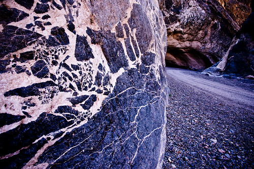
Geekier than normal post today. If you aren't interested in python programming, flickr's API and GPS display of images in Google maps or Google Earth then I'd stop reading now. Here's another picture from Death Valley. See you again tomorrow.

latitude, longitude, name, url, thumbnail, descEach line after that is one entry for an image, with the location in decimal degrees, followed by various text fields containing the description, title and links to the actual image. For example:
36.366953, -117.391867, "shot up car", "http://flickr.com/photos/mcgregorphoto/2355449153/", "http://farm3.static.flickr.com/2323/2355449153_c733f5ee1e.jpg", "a long way from nowhere, burnt out and shot up, just off the access road"
36.442947, -117.435447, "half way point", http://flickr.com/photos/mcgregorphoto/2356283640/, http://farm3.static.flickr.com/2388/2356283640_be78036888.jpg, "lunch about half way into the hike"
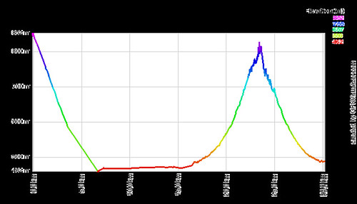
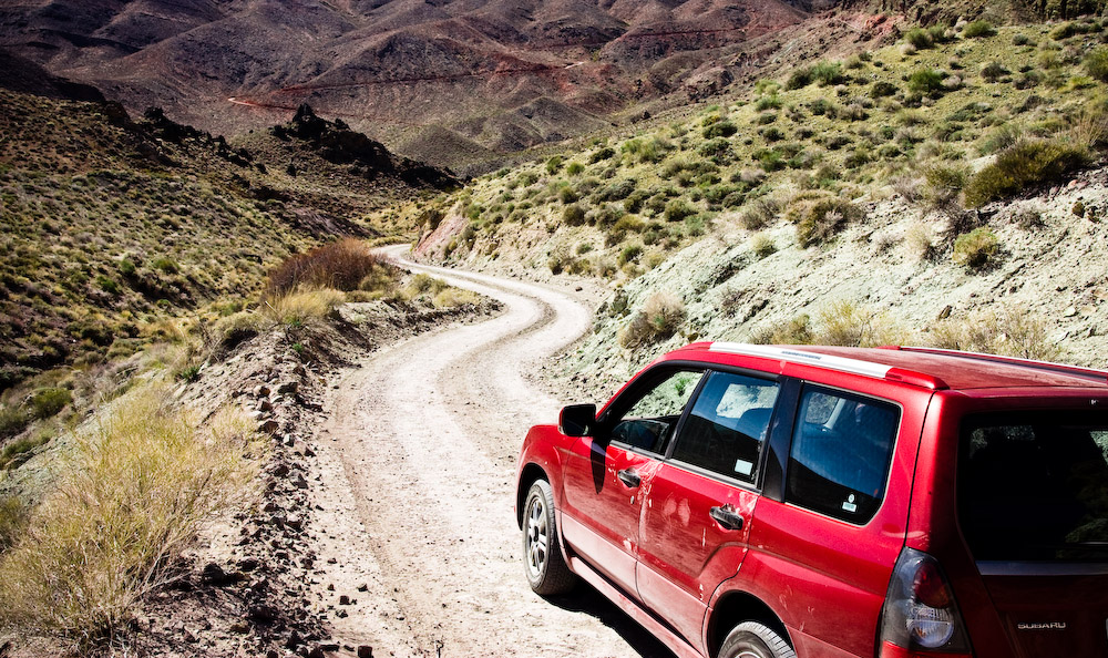
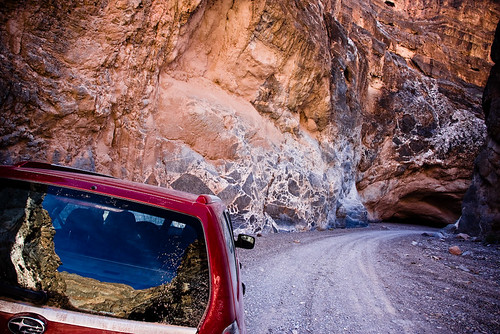
Initially I generated this file by hand, extracting the EXIF location from the image files using exiftool. I then went through each image, entered a title, found the URL for the image on flickr, extracted the URL for a thumbnail image and added a longer description. This was painful to say the least. It was only 16 images but it was a pain. Particularly as all the information was already there, in a flickr set. So I looked up the information on the flickr API, found a python library to access it and wrote the script below in half an hour. Given the URL or set id for a flickr set, it iterates over all of the photos and produces a CSV formatted list that's suitable to load straight into GPSVisualizer. This can then be linked along with the original GPS track log to generate a map with images and also the path traveled. It can be used for both Google Earth and Google maps path generation and runs pretty quickly. I'm posting it here in case it proves useful to anyone. To run, you'll need an up to date python install and additionally will need to download and install the flickrAPI for python. The final step is to obtain an API key for flickr. This key has to be added to the script, in the marked location. Once installed the program is run with:
python flickr2gpsv.py -s set_id > results.csvor, alternatively,
python flickr2gpsv.py -s http://www.flickr.com/set_url/ > results.csvIf you find this useful, please let me know. You can download the script here. (probably better than cutting and pasting from below, because the download will keep the correct indentation). The archived version also includes a patch from Brad Crittenden to add unicode support.
# Author : Gordon McGregor
# Contact: http://gordonmcgregor.blogspot.com
#
# License : public domain
#
# Purpose: parses a flickr set to extract information to generate a map overlay, via http://gpsvisualizer.com
#
# Usage: python flickr2gpsv.py -s 72157604221838137
# or
#        python flickr2gpsv.py -s http://flickr.com/photos/mcgregorphoto/sets/72157604221838137/
#
#   If the URL is given, the set_id is automatically extracted

# Typically, you'll want to  redirect the output to a file, as errors & comments will appear on stderr (not in the file)
#
# e.g., python flickr2gpsv.py -s 72157604221838137 > output_list.csv
#
#
# only generates entries for photos with geographic information attached
#
# Required libraries:
# the flickrapi python libraries, from http://flickrapi.sourceforge.net/
# installation info here http://flickrapi.sourceforge.net/installation.html
#

import flickrapi
import time

import sys
from optparse import OptionParser
from urlparse import urlparse

# enter your api_key here to connect to flickr
# obtain one from http://www.flickr.com/services/api/keys/apply/
#

api_key = 'your_key_goes_here'

def getURL(sizes, size):

for element in sizes.sizes[0].size:
if element['label'] == size:
    return element['source']

raise flickrapi.exceptions.FlickrError, "No " + size+ " URL found."

# the main routine
# pass in a flickr set id
# outputs the appropriate data for GPSVisualizer to stdout
def parseSet(set_id):

cnt = 0

flickr = flickrapi.FlickrAPI(api_key)

photoset = flickr.photosets_getPhotos(photoset_id=set_id)

# iterate over list of photos in list

print 'latitude, longitude, name, thumbnail, url, desc'
for photo in photoset.photoset[0].photo:

try:
# get the various bits of data

    sizes = flickr.photos_getSizes(photo_id = photo['id'])
    info  = flickr.photos_getInfo(photo_id =  photo['id'])

# extract the required fields
    try:
        lat = info.photo[0].location[0]['latitude']
        lon = info.photo[0].location[0]['longitude']
    except AttributeError:
        raise flickrapi.exceptions.FlickrError, "No Geographical data found."

    name = photo['title']
    thumbnail =  getURL(sizes, 'Small')
    url = info.photo[0].urls[0].url[0].text
    desc = info.photo[0].description[0].text.strip()  # strip to remove extra newlines

    if(len(desc)):
        print '%s, %s, "%s", "%s", "%s", "%s"' % (lat, lon, name, thumbnail, url, desc)
    else:
        print '%s, %s, "%s", "%s", "%s",' % (lat, lon, name, thumbnail, url)
    sys.stderr.write('.')
    cnt = cnt + 1

except flickrapi.exceptions.FlickrError, e:
    sys.stderr.write( '\n'+photo['title'] +' : ' + e.__str__() + ' Skipping.\n')

return cnt


def main(argv=None):
if argv is None:
argv = sys.argv

usage = "usage: %prog [options]\nPass in a flickr set to produce output suitable for GPSVisualizer's google maps overlay"
opt_parser = OptionParser(usage=usage)

opt_parser.add_option('-s', '--set', dest='set', help="flickr set to process (full url or set number)")

(options, args) = opt_parser.parse_args()

if(options.set == None):
opt_parser.print_help()
return 1

# treat the command line value as a url
url = urlparse(options.set)

# even if it is just a set id, the value ends up in field 3 after urlparse (url[2])
# this removes any trailing /, explodes around any remaining /'s and takes the last value [-1]
# works for a full URL or simple set id
set_id = url[2].strip('/').split('/')[-1]

if (not set_id.isdigit()):
sys.stderr.write("set_id" + set_id + "is not a number. This is not expected.")
return 1

sys.stderr.write("Processing set id "+set_id+"\n")
start_time = time.time()
num = parseSet(set_id)
end_time = time.time()

total_time = end_time - start_time

average = 0
if(num):
average = total_time/num

results = "\nProcessed %d valid photos in %0.1f seconds (%0.2f seconds/photo). Finished.\n" % (num, total_time, average)
sys.stderr.write(results)

if __name__ == "__main__":
sys.exit(main())
One of the reasons I went to Death Valley at the beginning of the month was to spend my birthday out there. Amanda was away for work and I wanted do something, rather than sitting around the house! I spent the first few days doing a bit of short hiking and taking a lot of pictures. I wanted to try something a bit more adventurous on my actual birthday. I got up bright and early on the 4th, at 4:30am and headed out to the Badwater salt flats to shoot the pre-dawn and sunrise. A quiet, soft start to the day and almost nobody out there. I walked out further than I've been before, about a mile and a half, to where the salt really gets flat and white. Peaceful, beautiful and not a sound. Amanda recorded herself singing 'Happy Birthday' on my birthday present, a digital audio recorder, so I listened to that a few times out there!

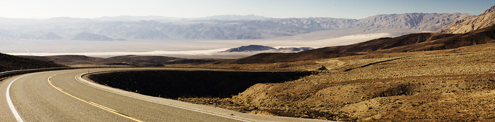
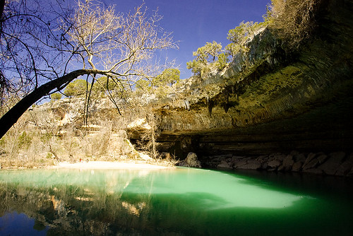 If you click on the shot of Hamilton pool, above, you can use the show on map option in the lower right to see where it was taken.
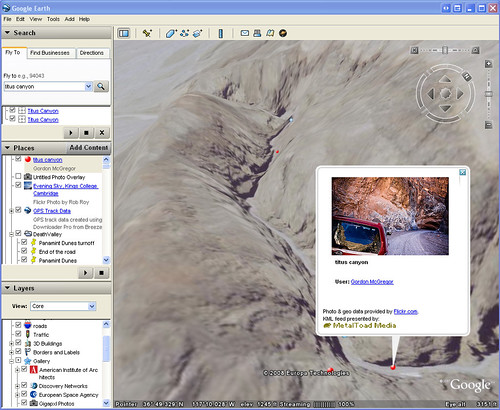
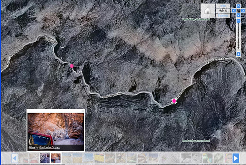
I am interested in any good examples of using geo-tagging in photos. It seems like a neat technology and fun to be able to see exactly where you were when you took a shot. I did use it quite a bit while scouting locations too, to mark a spot that I wanted to return to at a better time of day. Really then all I could have done was hit the mark button on the GPS and put a suitable name in. So far I've found this useful for sharing the location with others, more than anything else. When talking through the images, I could click on the GPS link and pull up the satellite view - handy to show just how far away from anything I was. In some other shots, it has been useful to be able to describe the route and thought process taken to finding a particular location. I have considered using it when out shooting in an urban area, to tag locations with great backgrounds for portraits - there are plenty around Austin and I occasionally forget where they are. Again there the information would be more useful for sharing those spots with others that might want to visit. I can already see my shots appearing automagically in Google Earth, when I switch on the flickr layers, which is quite neat. I'd actually like to work out if it is possible to include my images as floating billboards in Google Earth, when you fly past the location where they were shot. That might require directional information though, to really line up the scene.
Useful Links
If you click on the shot of Hamilton pool, above, you can use the show on map option in the lower right to see where it was taken.
I am interested in any good examples of using geo-tagging in photos. It seems like a neat technology and fun to be able to see exactly where you were when you took a shot. I did use it quite a bit while scouting locations too, to mark a spot that I wanted to return to at a better time of day. Really then all I could have done was hit the mark button on the GPS and put a suitable name in. So far I've found this useful for sharing the location with others, more than anything else. When talking through the images, I could click on the GPS link and pull up the satellite view - handy to show just how far away from anything I was. In some other shots, it has been useful to be able to describe the route and thought process taken to finding a particular location. I have considered using it when out shooting in an urban area, to tag locations with great backgrounds for portraits - there are plenty around Austin and I occasionally forget where they are. Again there the information would be more useful for sharing those spots with others that might want to visit. I can already see my shots appearing automagically in Google Earth, when I switch on the flickr layers, which is quite neat. I'd actually like to work out if it is possible to include my images as floating billboards in Google Earth, when you fly past the location where they were shot. That might require directional information though, to really line up the scene.
Useful Links